So far in 2024, winter weather has already proven to be quite a handful by bringing widespread freezing temperatures, plenty of snowfall, and flooding rains. But once the weather begins to warm up, many will start anxiously anticipating what surprises this year's hurricane season could bring. Experts often try to monitor conditions to determine roughly how many severe storms we can expect. And so far, meteorologists say there's evidence that 2024 will "amplify hurricane activity" when the season kicks off. Read on to see how this season will be different and how it could affect you.
RELATED: "Arctic Blast" and Widespread Snow Predicted for Next Month—Here's Where.
Last year's hurricane season was very active—but not as destructive as others.
Months after it ended, the 2023 hurricane season remains notable for several reasons—and could also provide some insight into how this year's could play out. Record-high ocean temperatures in the Atlantic brought about a particularly active season, with 20 named storms forming over the six-month period, pushing it above the running average of 14, the Miami Herald reported.
The intensity of the storms was also notably high: Seven systems developed into hurricanes, including three that reached Category 3 or higher. But despite the high potential for catastrophe, Hurricane Idalia and a pair of tropical storms were the only storms that ever made landfall in the U.S., per the Miami Herald.
"It was one for the books," Phillip Klotzbach, a meteorologist and researcher at Colorado State University, told the newspaper. "But overall, a benign season."
Other experts pointed out that while the El Niño conditions seen last year typically reduce the number of storms, extreme conditions appear to have steamrolled the normal effect it has. "Without that temperature contrast, if the Atlantic is very, very warm and the Pacific is warm, it just doesn't drive those unfavorable winds in the same way," Ryan Truchelut, chief meteorologist of private weather service Weather Tiger, told the Herald.
RELATED: A "Polar Vortex" Is Expected to Hit the U.S. Soon—Here's What to Know.
Higher-than-average ocean temperatures could lead to a similar or worse hurricane season this year.
Now, some experts are warning that we should expect a similarly active season this year. Some point to the lingering high temperatures in the Atlantic that might help fuel more storms.
"The Atlantic Ocean last year had some very warm sea surface temperatures—in fact, record warm in places," Adam Lea, PhD, a climate physicist at TropicalStormRisk.com, said during an interview with Fox Weather on Jan. 29. "With all that heat that's accumulated in the oceans, it's going to take a long time for all that to dissipate."
While conditions could change, Lea says that the current winter readings show the ocean will likely not have enough time to release heat before warmer weather arrives leading into the start of hurricane season in June.
"It's not just the tropical Atlantic at the moment," he told Fox Weather. "It's all the subtropical Atlantic as well. Off the coast of Spain, in a kind of swath all the way down the Canary Islands, into the subtropics and across the Atlantic, that's very warm at the moment."
RELATED: 9 Dangerous Things You Should Never Do During a Thunderstorm.
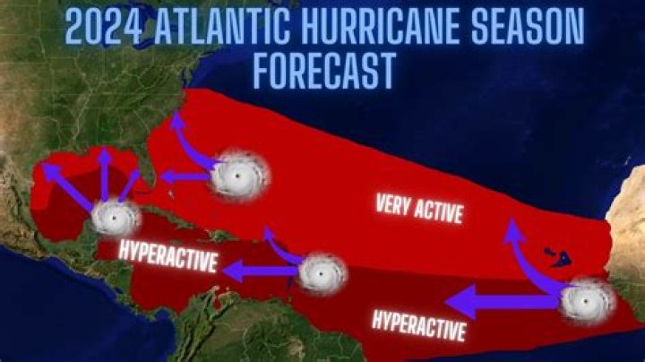
Experts warn that a lack of El Niño conditions could "amplify the hurricane activity."
But while some of last year's lingering conditions could contribute to another busy season, one other element will disappear that could worsen the outlook. Namely, the warmer Pacific waters that typically create a buffer against more active storm development won't be there this upcoming season.
"The El Niño that's currently in place has now peaked and is predicted to gradually dissipate as we go through spring," Lea told Fox Weather. "And when we get into peak hurricane season from about August onwards, the signals are that the model forecasts I've looked are suggesting, are going for, if anything, a weak La Niña in place by the time we get through August, September, and October, which would act also to amplify the hurricane activity."
These conditions could also mean more storms making landfall, as La Niña can reduce the crosswinds that sometimes knock storms off course, The Washington Post reports. Along with the currently above-average temperatures in the Gulf of Mexico, this could lead to greater risk for historically vulnerable areas in the U.S.
Conditions could still change for the better, but the long-term outlook for hurricanes might be different.
Despite the current evidence, experts still warn that the current forecast is only an estimate and that a hyperactive hurricane season is not a foregone conclusion.
"Of course, there is still some uncertainty in the sea surface temperatures," Lea told Fox Weather. "I mean, it's not to say that something might happen or change rapidly in the atmosphere that might act to cool sea surface temperatures. You can't rule that out completely. But at the moment, it's more likely than not that the sea surface temperatures in the tropical Atlantic will be warmer than average. Maybe not as warm as they have been recently, but still warmer than average."
But meteorologists are now also speculating that, even beyond 2024, previously held theories might no longer apply in the face of climate change.
"It's alarming to me that you can't count on El Niño to reliably reduce hurricane risk. We've learned that is subject to external factors that can override it," Truchelut told the Miami Herald. "The rules may no longer apply, unfortunately."
RELATED:For more up-to-date information, sign up for our daily newsletter.
Zachary Mack Zach is a freelance writer specializing in beer, wine, food, spirits, and travel. He is based in Manhattan.Read moreFiled UnderNews • Science • WeatherRead This NextMajor Hurricanes Intensifying, New Data Shows
A few parts of the U.S. should be more prepared than ever. October 26, 2023Polar Vortex May Bring "Severe Weather"
The polar vortex has already been acting "squirrely," experts say.January 23, 2024"Arctic Blast" and Snow Predicted Next Month
February could see a repeat of the freezing temperatures and powder that kicked off 2024.January 25, 2024How "Extreme" Storms Will Affect Your Region
Straight-line winds impact parts of the United States in different ways.November 25, 2023Why Weather Predictions Keep Changing
A strange change in the familiar phenomenon could be holding off a wet and snowy winter—for now.November 29, 2023Why You Shouldn't Trust the Farmer's Almanac
Here's what to look at instead, according to meteorologists.October 29, 202339 Facts About Storms You Need to Know
Learn all about this mysterious and often dangerous weather phenomenon.August 28, 20239 Things You Shouldn't Do During a Thunderstorm
Emergency preparedness experts share their top tips for staying safe.July 13, 2023Never Use GPS During a Snowstorm
Your desire to bypass closed or backed-up roads could put you in a worse situation.February 6, 202310 Ways to Prepare Your Home for a Snowstorm
These tips are not the obvious pieces of advice you're used to.January 14, 2023